BlackburnImages' Gallery
2022 - Death Valley
https://blackburnimages.slickpic.com/albums/2022-Death-Valley/photo/#18520744
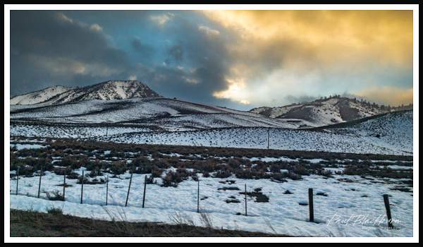
Snowstorm on Highway 395 Driving south on Highway 395 we encounter a snowstorm near Mack Canyon. Coleville, California, USA
https://blackburnimages.slickpic.com/albums/2022-Death-Valley/photo/#18520743
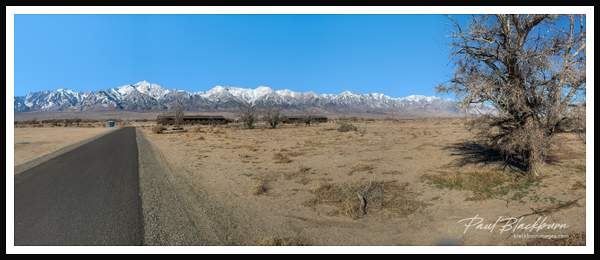
Manzanar Relocation Camp Eastern Sierra Nevada Mountainss seen from Manzanar. Site of internment camps of 10,000 persons of Japanese ancestory, many American citizens, in 1942 - 1945. Manzanar, California, USA.
https://blackburnimages.slickpic.com/albums/2022-Death-Valley/photo/#18520740
Entering Death Valley National Park
https://blackburnimages.slickpic.com/albums/2022-Death-Valley/photo/#18520738
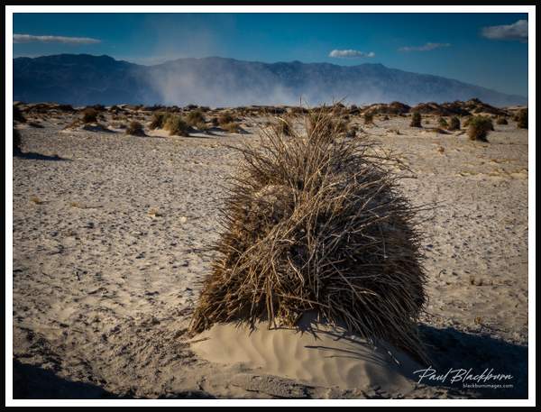
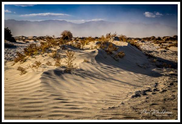
Arrowweed in Devil's Cornfield An approaching sandstorm viewed from Devil;s Cornfield. The plants that some thought resembled bundles of corn stalks is Arrowweed.. Death Valley, California, USA
https://blackburnimages.slickpic.com/albums/2022-Death-Valley/photo/#18520737
Sand dune in the Devil's Cornfield with approaching sand storm. Visibility would be severly limited in just a few minutes. Death
https://blackburnimages.slickpic.com/albums/2022-Death-Valley/photo/#18520735
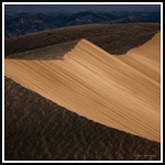
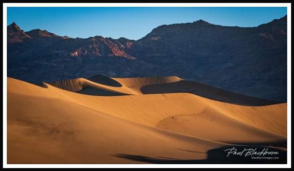
Morning sunlight on the dunes. Morning's first light illuminates sand dunes in Mesquite Flat Sand Dunes, Death Valley, California, USA
https://blackburnimages.slickpic.com/albums/2022-Death-Valley/photo/#18522121
Mesquite Flat Dune sunrise Sunrise light hits one of the dunes in Mesquite Flat Sand Dunes. Death Valley National Park, California, USA
https://blackburnimages.slickpic.com/albums/2022-Death-Valley/photo/#18522119
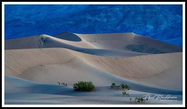
Mesquite Flat Sand Dunes blue hour Predawn view of sand dunes in Mesquite Flat Sand Dunes, Death Valley National Park, California, USA
https://blackburnimages.slickpic.com/albums/2022-Death-Valley/photo/#18520733
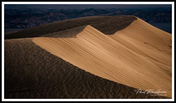
Morning shadows Early morning light and shadows on sand dunes. Mesquite Flat Sand Dunes, Death Valley National Park, California, USA
https://blackburnimages.slickpic.com/albums/2022-Death-Valley/photo/#18520732
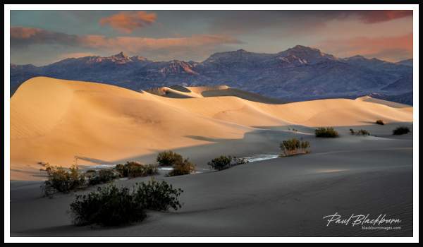
Mesquite Flat Sand Dunes Mesiquite Flat Sand Dues in the early morning light with the Armogosa Mountain range in the background. Death Valley National Park, California, USA
https://blackburnimages.slickpic.com/albums/2022-Death-Valley/photo/#18520730
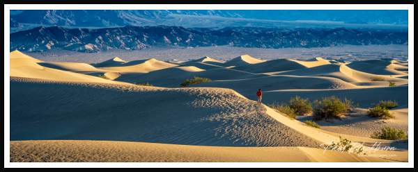
Dune hiker Early morning hiker on the Mesquite Flat Sand Dunes, Death Valley National Park, California, USA
https://blackburnimages.slickpic.com/albums/2022-Death-Valley/photo/#18520728
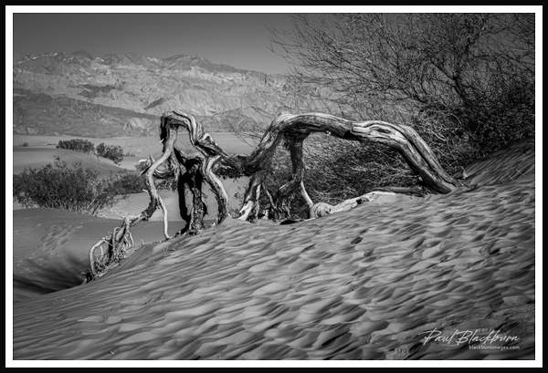
Weathered bush Weathered bush in sand dune at Mequite Flat Sand Dunes, Dealth Valley National Park, California, USA.
https://blackburnimages.slickpic.com/albums/2022-Death-Valley/photo/#18520726
Golden Canyon Golden Canyon looking towards Telecope Peak in the Panamint Mountains. Death Valley National Park, California, USA.
https://blackburnimages.slickpic.com/albums/2022-Death-Valley/photo/#18520724
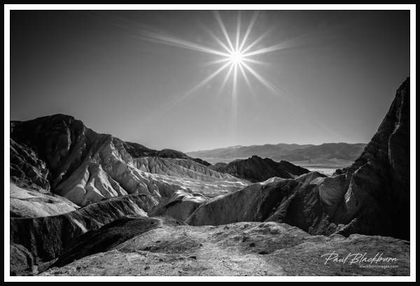
Desert sun Desert sun shines bright in Golden Canyon looking towards Telescope Peak in Panamint Mountains. Death Valley National Park, California, USA.
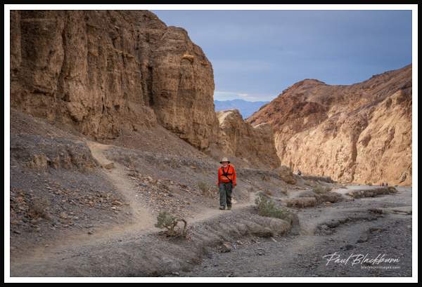
https://blackburnimages.slickpic.com/albums/2022-Death-Valley/photo/#18520723
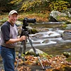
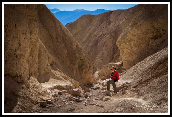
Golden Canyon hiker Tom Blackburn hiking the trail to Red Cathedral in Golden Canyon. Death Valley National Park, California, USA.
https://blackburnimages.slickpic.com/albums/2022-Death-Valley/photo/#18520721
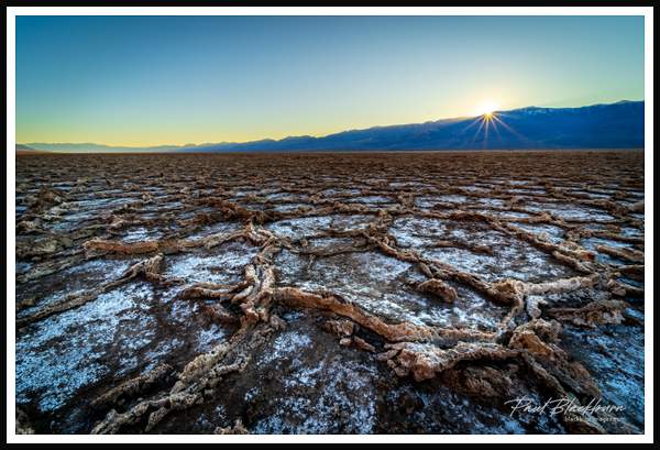
Badwater Basin Setting sun highlights the geometric patterns of the salt flats of Badwater Basin, the lowest point in North America at 282 feet below sea level. Death Valley National Park, California, USA.
https://blackburnimages.slickpic.com/albums/2022-Death-Valley/photo/#18520719
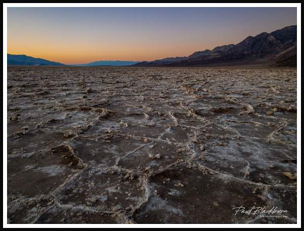
Salt flats Salt flats of Badwater Basin in the glow of sunset. The basin consists of a small spring-fed pool of "bad water" next to the road in a sink. Repeated freeze–thaw and evaporation cycles gradually push the thin salt crust into hexagonal honeycomb shapes. Death Valley National Park, California, USA.
https://blackburnimages.slickpic.com/albums/2022-Death-Valley/photo/#18520717
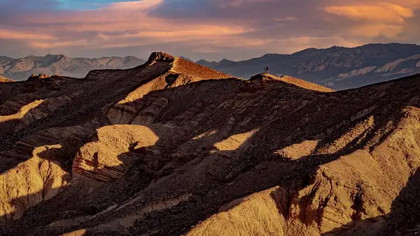
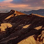
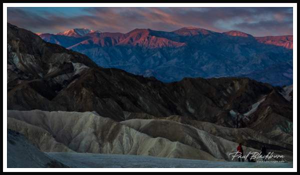
Zabriski Point Setting moon at Zabriski Point, Death Valley National Park, California, USA
https://blackburnimages.slickpic.com/albums/2022-Death-Valley/photo/#18520716
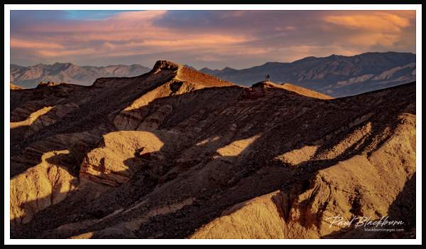
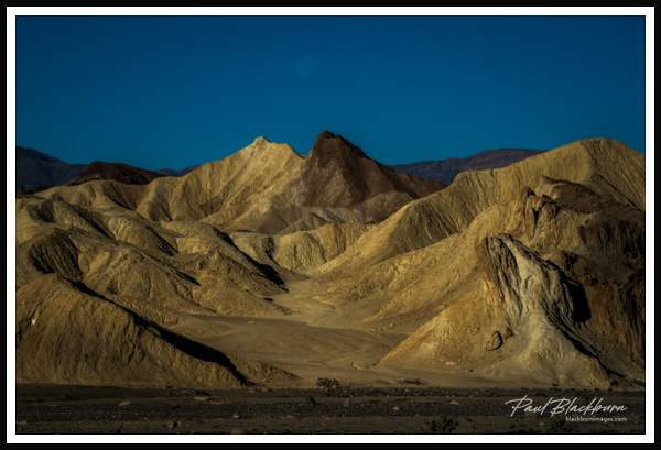
First light on Panamints Morning's first light shines on the Panamint Mountains viewed from Zabriski Point, Death Valley National Park, California, USA.
https://blackburnimages.slickpic.com/albums/2022-Death-Valley/photo/#18520714
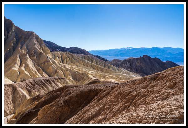
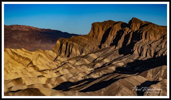
Layers Layers of rock are striking in the morning light near Zabriski Point, Death Valley National Park, California, USA
https://blackburnimages.slickpic.com/albums/2022-Death-Valley/photo/#18520712
Zabriski Point sunrise Morning light illuminates the east facing side of Zabriski Point, Death Valley, California, USA.
https://blackburnimages.slickpic.com/albums/2022-Death-Valley/photo/#18520749
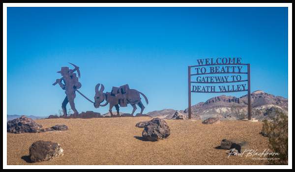
Welcome sign Sign welcoming vistors driving from Death Valley to Beatty, Nevada. About 120 miles northwest of Las Vegas, aside from tourism, local businesses include mining, retail trade, public administration and gambling. Beatty, Nevada, USA.
https://blackburnimages.slickpic.com/albums/2022-Death-Valley/photo/#18520748
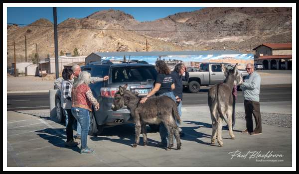
Beatty Burros A local herd of wild burros freely roam Beatty and welcome most visitors in town. Beatty, Nevada, USA.
https://blackburnimages.slickpic.com/albums/2022-Death-Valley/photo/#18520747
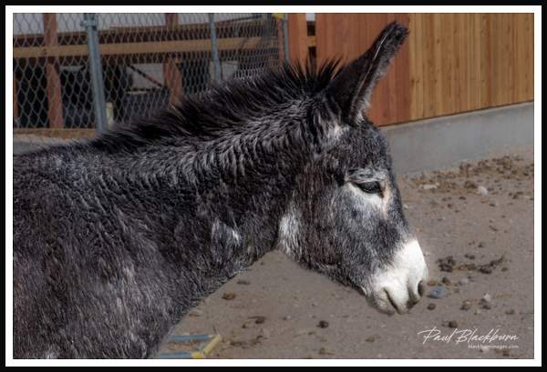
Wild burro One of the wild burros that roam the town of Betty, Nevada, USA.
https://blackburnimages.slickpic.com/albums/2022-Death-Valley/photo/#18520746
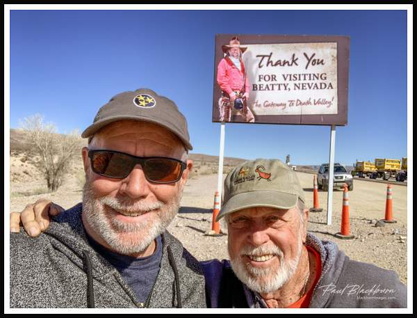
Brothers Tom and Paul Blackburn after visiting Beatty, Nevada a very small town on the east side of Death Valley National Park. USA
https://blackburnimages.slickpic.com/albums/2022-Death-Valley/photo/#18520745
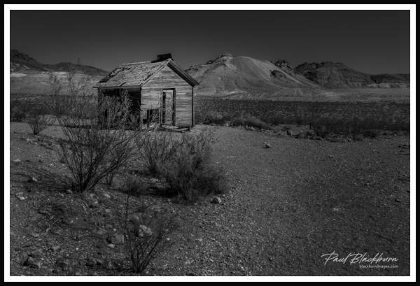
Ghost town cabin Cabin in Rhyolite, a boom town founded in 1904 and at its peak in 1907 had 4,000 residents. Nevada, USA
https://blackburnimages.slickpic.com/albums/2022-Death-Valley/photo/#18520742
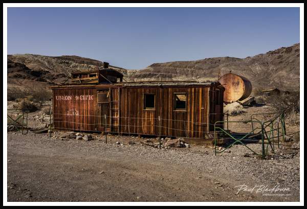
Caboose house Caboose house was used as a filling station in the 1920s. Rhyolite, Nevada, USA
https://blackburnimages.slickpic.com/albums/2022-Death-Valley/photo/#18520741
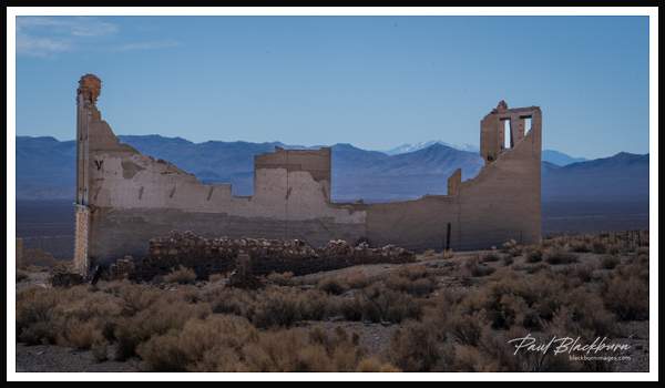
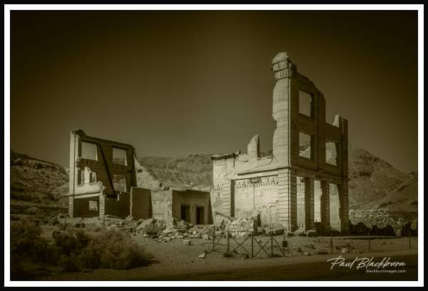
Rhyolite bank building Rhyolite in 1907 had concrete sidewalks, electric lights, water mains, telephone and telegraph lines, daily and weekly newspapers, a monthly magazine, police and fire departments, a hospital, school, train station and railway depot, at least three banks, a stock exchange, an opera house, a public swimming pool and two formal church buildings. Most prominent was the three-story John S. Cook and Co. Bank on Golden Street.Rhyolite, Nevada, USA
https://blackburnimages.slickpic.com/albums/2022-Death-Valley/photo/#18522118
Cook Bank building Rhyolite, a ghost town in the Armogosa Desert, boomed in the early 1900's but went bust when ore ran out in 1910. Rhyolite, Nevada, USA.
https://blackburnimages.slickpic.com/albums/2022-Death-Valley/photo/#18520739
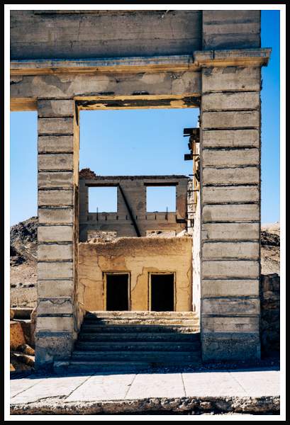
_PB50110.jpg The tallest building in Rhyolite, the Cook Bank building cost its owner $90,000 to build in 1908 including Italian marble, stained glass windows, and other luxuries. Rhyolite, Nevada, USA.
https://blackburnimages.slickpic.com/albums/2022-Death-Valley/photo/#18522117
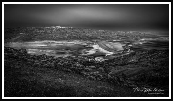
Badwater Basin Badwater Basin and Panamint Mountains. Death Valley National Park, California, USA
https://blackburnimages.slickpic.com/albums/2022-Death-Valley/photo/#18520736
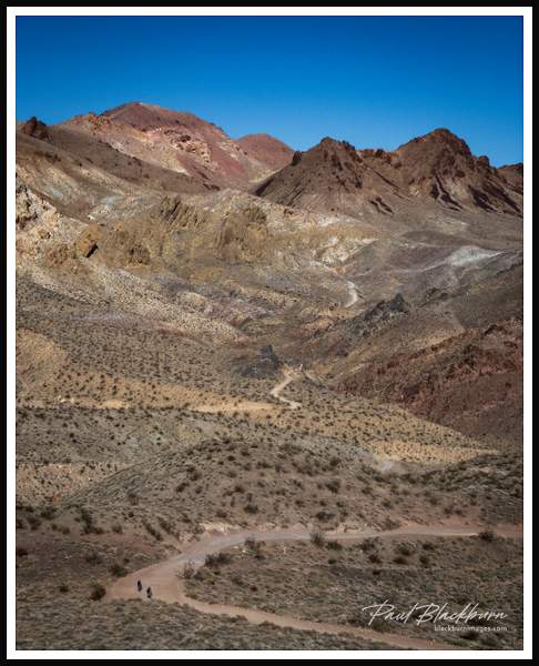
Titus Canyon A 27 mile one way, back country road, Titus Canyon Road, starts in Nevada and ends on Death Valley National Park. The two cyclists are descending Red Pass. Titus Canyon, Death Valley National Park, California, USA.
https://blackburnimages.slickpic.com/albums/2022-Death-Valley/photo/#18520734
Titus Canyon Road A 27 mile one way, back country road, descending Red Pass on its way to Leadfield and Titus Canyon. Death Valley National Park, California, USA
https://blackburnimages.slickpic.com/albums/2022-Death-Valley/photo/#18520731
Leadfield Leadfield, built on decit and fraud by CC Julian, flourished in 1925 and 1926. Located in Titus Canyon in the Grapevine Mountains and is evidence of the get-rich-quick schemes of the 1920s. Leadfield, California, USA.
https://blackburnimages.slickpic.com/albums/2022-Death-Valley/photo/#18520729
Setting moon
https://blackburnimages.slickpic.com/albums/2022-Death-Valley/photo/#18520727
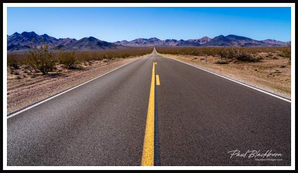
Highway to Death Valley Highway 127 from Shoshone, California leads into Death Valley National Park. California, USA
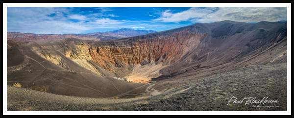
https://blackburnimages.slickpic.com/albums/2022-Death-Valley/photo/#18520725
Ubehebe Crater Panorama view of Ubehebe Crater in the northern half of Death Valley National Park. Created by a volcanic explosion as recently as 2,100 years ago.
https://blackburnimages.slickpic.com/albums/2022-Death-Valley/photo/#18520722
Hiking Mosaic Canyon Tom Blackburn, hiking on the trail into Mosaic Canyon, Death Valley National Park, California, USA.
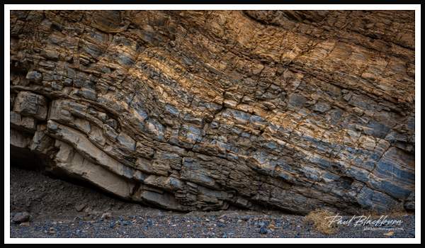
https://blackburnimages.slickpic.com/albums/2022-Death-Valley/photo/#18520720
Mosaic layers Exposed layers of different rock types show the sedimentary layers that give Mosaic Canyon its name. Death Valley National Park, California, USA.
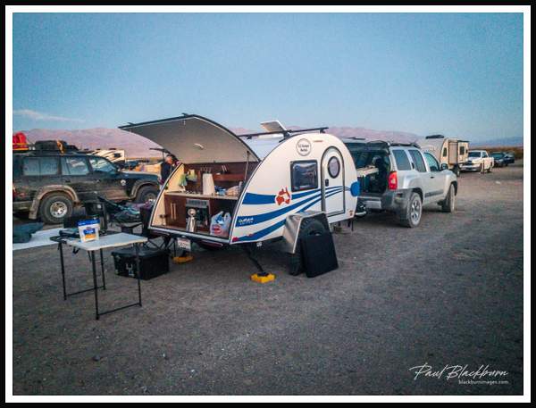
https://blackburnimages.slickpic.com/albums/2022-Death-Valley/photo/#18520718
Lodging Rented an off-road tear drop trailer from E-Z-Kampin for our lodging in Death Valley National Park, California, USA
https://blackburnimages.slickpic.com/albums/2022-Death-Valley/photo/#18520715
Father Crowley overlook
https://blackburnimages.slickpic.com/albums/2022-Death-Valley/photo/#18520713
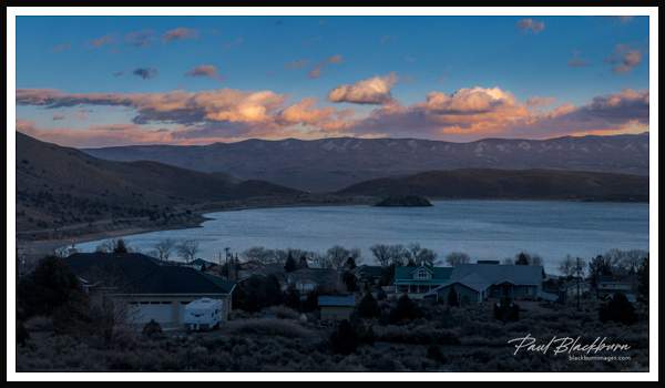
Topaz Lake Sunset at Topaz Lake, Nevada from our lodging at Topaz Lodge. California/Nevada border bisects this lake.
Scroll To Top
Audio Mute
Prev
Play
Next
Shuffle
Include
This site uses cookies to enhance your browsing experience, serve personalized content, and analyze traffic. By continuing to use this site you agree to
use of cookies and stewardship of your data .


No comments yet...
All fields are required, fill in the form.
Comment successfully added.
Comment